Teaching
Open-access drone mapping course
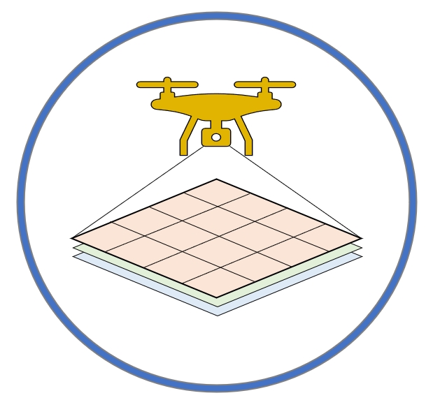 An open-access drone mapping training course has been developed to leverage drone technology for collecting high-resolution remote sensing data, supporting coastal mapping and seagrass conservation efforts. Designed for research partners and broader communities, the course provides hands-on training in drone operation and geospatial data processing using Geographic Information Science (GIS) methods. The curriculum covers key topics, including drone flight operations, coastal mapping principles, safety protocols, preflight planning, FAA Part 107 certification, drone image stitching software, geographical fieldwork techniques, and GIS-based remote sensing analysis. By integrating drone technology with GIS and remote sensing, the course equips participants with essential skills for environmental monitoring and spatial data analysis.
UCSC ENVS/GIST 115/215A: Introduction to GIS
 ENVS/GIST 115/215A provides students with a foundational understanding of Geographic Information Systems (GIS), emphasizing spatial data types, coordinate systems, and map projections. Students gain hands-on experience with ArcGIS Pro, learning how to visualize, analyze, and manage geospatial data. The course introduces fundamental spatial analysis techniques such as buffering, overlay, and geocoding while covering essential cartographic principles for effective map design. By the end of the course, students can interpret and manipulate GIS data to support environmental decision-making. Through lab exercises and real-world applications, they develop the technical skills necessary to work with spatial data effectively.
UCSC ENVS/GIST 115/215B: Intermediate GIS
 ENVS/GIST 115/215B builds upon the skills acquired in 115A, introducing advanced spatial analysis techniques and geospatial database management. Students learn to perform raster-based analysis, work with remotely sensed data, and apply geoprocessing tools for spatial modeling. The course also covers environmental applications such as land use change detection, habitat suitability modeling, and hydrological analysis. Emphasis is placed on integrating multiple data sources, managing large geospatial datasets, and conducting spatial statistics to support environmental research. By the end of the course, students develop a strong understanding of analytical GIS techniques and their practical applications in environmental science.
UCSC ENVS/GIST 115/215C: Advanced GIS
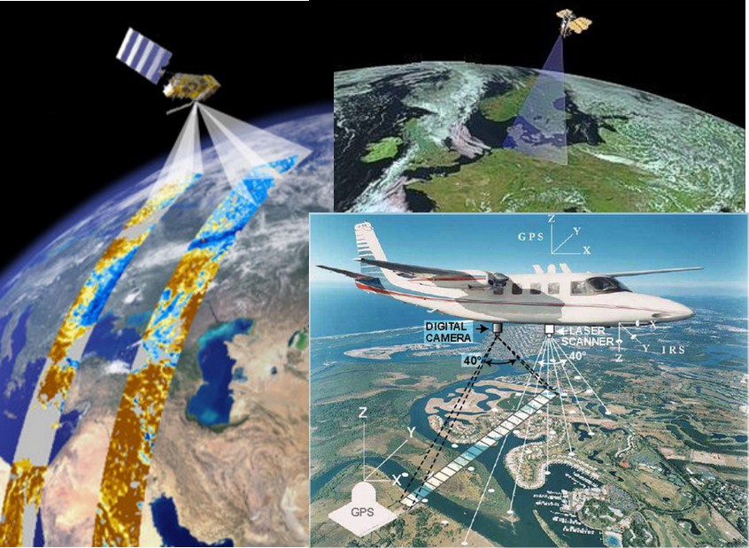
 ENVS 115C (Advanced GIS) explores high-level geospatial analysis, integrating geospatial AI, remote sensing, and advanced spatial modeling methods to address real-world environmental challenges. Students gain experience with Google Earth Engine for large-scale geospatial analysis and use drone technology for remote sensing data collection. The course also includes processing and analyzing LiDAR and UAV-derived imagery for environmental applications. Through an independent project, students apply their knowledge to solve a real-world geospatial problem, refining their technical skills and problem-solving abilities. By completing the course, they are well-prepared for professional roles in GIS analysis, environmental consulting, and geospatial research.
UCSC ENVS 196G: Senior Seminar in GIS
Capstone course for students concentrating in GIS, it requires to complete a comprehensive GIS project. Students identify a research question in environmental science, urban planning, or conservation and design a geospatial workflow using spatial analysis, remote sensing, and GIS modeling. They work with real-world datasets, applying techniques like land cover classification, suitability analysis, or change detection. The course culminates in a professional-quality GIS report and presentation, demonstrating their ability to conduct independent geospatial research. This seminar prepares students for careers or graduate studies by refining analytical, problem-solving, and communication skills.